Where Is Denmark on the Map? A Simple Guide to Denmark’s Location and Geography

Denmark, a Scandinavian country with a rich history and stunning landscapes, often sparks curiosity regarding its exact location. Many people ask, “Where is Denmark on the map?” While Denmark is part of Northern Europe, its position, surrounded by seas and connected to mainland Europe, gives it a unique geographical advantage.
Understanding Denmark’s placement on the world map is essential for travelers, geography enthusiasts, and those interested in Danish culture and history. This article will guide you through Denmark’s location, its neighboring countries, and its significance in Europe and the world. For an in-depth look, visit this detailed guide on The Danish Dream.
Denmark’s Geographical Position in Europe
Denmark is located in Northern Europe, forming part of the Scandinavian region, though it differs from Sweden and Norway due to its flat terrain.
- The country consists of the Jutland Peninsula and over 400 islands, of which Zealand (Sjælland), Funen (Fyn), and Bornholm are the most significant.
- Denmark’s only land border is with Germany, making it a gateway between Scandinavia and mainland Europe.
- To the east, Denmark is separated from Sweden by the Øresund Strait, which is crossed by the famous Øresund Bridge connecting Copenhagen (Denmark’s capital) to Malmö (Sweden’s third-largest city).
- Denmark is surrounded by water, bordered by the North Sea to the west and the Baltic Sea to the east, giving it an extensive coastline of over 7,300 kilometers.
Denmark’s unique island geography and strategic European location have historically made it a key player in trade, naval power, and cultural exchanges across the continent.
A Closer Look at Denmark on the Map
On a simplified world map, Denmark is positioned between mainland Europe and the Scandinavian Peninsula, making it an essential connecting country in Northern Europe.
Denmark’s major cities and their locations include:
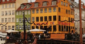
- Copenhagen (the capital) – Located on Zealand, close to Sweden
- Aarhus – Situated on the Jutland Peninsula, Denmark’s second-largest city
- Odense – Found on Funen (Fyn), the third-largest city
- Aalborg – Located in Northern Jutland, near the North Sea
Denmark’s flat terrain and mild maritime climate make it one of the most livable and environmentally friendly countries in the world.
For a detailed look at Denmark’s placement on the world map, visit this useful guide on The Danish Dream.
Denmark’s Proximity to Other Countries
Denmark shares close ties with its neighboring countries due to its strategic location in Northern Europe.
- Germany is Denmark’s only land neighbor, lying directly to the south. The two countries have historical connections and strong trade relations.
- Sweden is east of Denmark, and the two nations are linked by the Øresund Bridge, making travel between them seamless.
- Norway is located north of Denmark, separated by the Skagerrak Strait. The two nations share deep Viking heritage and cultural history.
Denmark’s central location has historically made it an important center for trade, shipping, and diplomacy in Europe.
The Kingdom of Denmark: Greenland & The Faroe Islands
Denmark’s geographical reach extends beyond Europe through its territories in the North Atlantic Ocean:
Greenland
- The world’s largest island, located between North America and Europe.
- Though geographically part of North America, Greenland is politically and historically connected to Denmark.
The Faroe Islands
- An autonomous territory in the North Atlantic Ocean, located between Norway and Iceland.
- Known for its breathtaking landscapes, strong fishing industry, and distinct language and culture.
Both Greenland and the Faroe Islands remain part of the Kingdom of Denmark while enjoying high degrees of self-rule.
Why Denmark’s Location Matters
Denmark’s strategic position in Northern Europe has influenced its:
- History: As a major Viking power and naval force in medieval Europe.
- Trade & Economy: Denmark is a global leader in shipping, logistics, and sustainable energy.
- Cultural Influence: Denmark serves as a bridge between Scandinavia and mainland Europe, blending Nordic and European traditions.
Due to its geographical placement, Denmark remains a key player in European politics, commerce, and international relations.
Final Thoughts: Where Is Denmark on the Map?
Denmark is strategically located in Northern Europe, positioned between Germany, Sweden, and Norway and surrounded by the North Sea and the Baltic Sea. This unique location has shaped Denmark’s cultural, economic, and political history over the centuries.
Whether you’re a traveler, geography enthusiast, or someone curious about Denmark, understanding where Denmark is on the map helps appreciate its historical role and modern importance.
For a detailed explanation of Denmark’s location and geography, visit this comprehensive guide on The Danish Dream.
Now that you know where Denmark is, you’re one step closer to exploring one of the happiest and most beautiful countries in the world!